Design with context
Generate 3D site models using global GIS and LiDAR data. Ready to download in minutes.
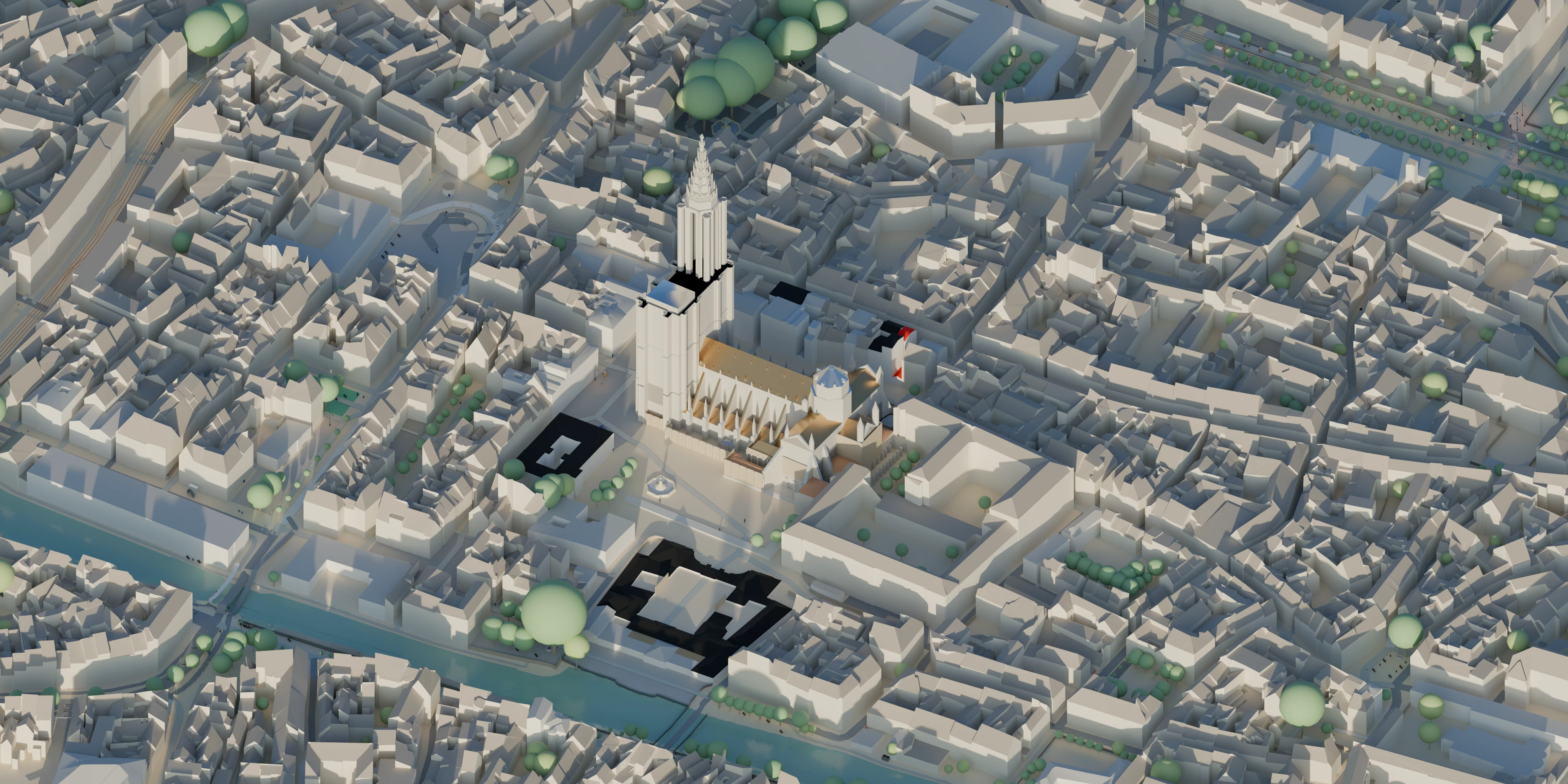
Every layer built from the best available data. Ready to use, no cleanup needed.
High resolution terrain
Up to 0.4 m resolution. Optimized TIN derived directly from LiDAR. Each surface cleanly separated by material with watertight geometry throughout.
LiDAR precision
Where open data falls short, LiDAR fills in. True building heights, roof geometry, and detailed tree canopies.
Best practices, built in
Careful UV unwrapping, instancing, material assignment, and layer organization throughout.
Made with Maquette
A collection of sites we love. Explore any in 3D and download for free.
Create your ownGlobal coverage at the highest available resolution.
Sourced directly from national survey programs. Every dataset properly licensed and attributed.
Global land coverage.
Countries with LiDAR coverage.
Common questions
No, but our models are geolocated and accurate enough for conceptual design, feasibility, and rendering. When your survey arrives, import it and everything lines up.
Every model is built in the site's local coordinate system. Choose any CRS on download and we handle the reprojection, or keep it centered at the origin.
Yes. Download in metres or feet. We handle the conversion so the model is ready to drop into your project.
The preview shows the best version of everything. Your download includes all the underlying data, so you have full control over what you keep.
Yes. Once you own the model you can use it for anything, including client work, planning applications, renders, or publications. The only exception is reselling the model itself, which is against our Terms of Service.
Pricing that scales with your project
Pay once. Own forever.
Come back and re-export as new data becomes available.
Ready to start building?
Pick your site. Generate and preview, completely free.